A Map Published in Defeat
The French and Indian War, which lasted from 1754 to 1763 and formed the North American theatre of the broader Seven Years' War, began badly for Britain. In July 1755, General Edward Braddock marched 2,100 British soldiers toward Fort Duquesne, a French stronghold near present-day Pittsburgh that controlled access to the Ohio Valley. A French garrison of roughly 250 marines and Canadian militia, supported by some 640 Native American allies, met them at the Monongahela River on July 9th. The result was one of the worst defeats British regular forces suffered during the entire eighteenth century: 456 killed, 422 wounded, and 26 of 86 commissioned officers dead on the field. Braddock himself was mortally wounded and died four days later.
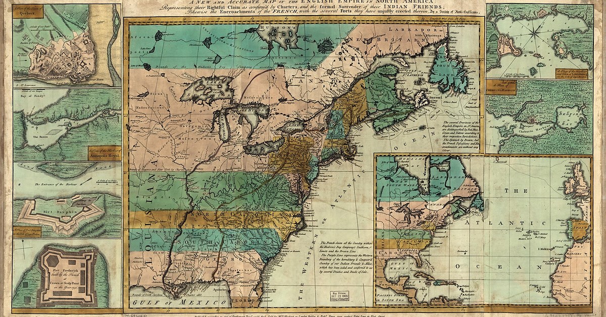
Five months after this catastrophe, in December 1755, a London organization called the Society of Anti-Gallicans published a map. Its full title ran to forty words and repays careful reading: A New and Accurate Map of the English Empire in North America: Representing their Rightful Claim as confirm'd by Charters, and the formal Surrender of their Indian Friends; Likewise the Encroachments of the French, with the several Forts they have unjustly erected therein.
The word accurate in an eighteenth-century map title deserves scrutiny. This was a map that described vast stretches of French-controlled territory as rightfully British, published at the precise moment when British forces had demonstrated their inability to take that territory by force. The gap between what the map asserted and what the army could deliver tells you a great deal about what the map was for.
The Society
The Society of Anti-Gallicans had been organized around 1745, during King George's War, as a patriotic and commercial club opposed to French influence in Britain. Their concerns blended economics with nationalism in ways that were characteristic of the period: French goods flowed into English markets, French territorial ambitions in North America threatened English colonial trade, and the Society believed that both problems had the same solution. They appointed distinguished presidents, including Lord Carpenter and Sir Edward Vernon, held regular meetings, outfitted at least one privateer to harass French merchant shipping, and published propaganda in several forms: patriotic songs, medals, anti-French prints, and pamphlets designed to harden public opinion against accommodation with France.
The map was their most consequential publication. William Herbert, described by contemporaries as one of the most outspoken members of the Society, engraved it. Robert Sayer, an established London map publisher with a long career ahead of him, published it. The hand-colored engraving measured roughly seventeen by twenty inches, a size intended for display in a study or office where it could make its argument to every visitor who glanced at the wall.
What the Map Claims
The Anti-Gallicans map presents the most aggressive interpretation of British territorial rights published during this period. British claims stretch from the Atlantic seaboard deep into the continental interior, grounded in two kinds of legal authority: the original colonial charters, which often drew boundaries extending vaguely westward to the Pacific, and treaties with the Iroquois Confederacy, which the map's makers interpreted as formal surrenders of Native American sovereignty over enormous territories. French forts along the Ohio, the Mississippi, and the Great Lakes appear on the map, but they are labeled as encroachments, unjustly erected on soil that belonged, by right, to Britain.
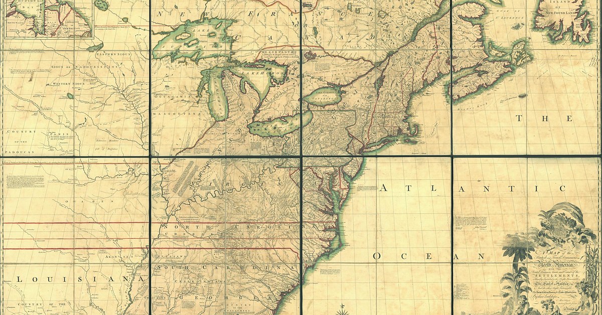
The cartography drew heavily on the work of John Mitchell, whose 1755 Map of the British and French Dominions in North America had been commissioned by the Board of Trade and represented the most authoritative survey of competing claims available at the time. Mitchell, however, had presented the territorial dispute with some degree of nuance. The Anti-Gallicans map dispensed with nuance entirely and pushed the political geography well beyond what even Mitchell had claimed, extending British sovereignty over regions where no British settler or soldier had set foot.
The treatment of Native American nations in the map's title is revealing. The phrase "the formal Surrender of their Indian Friends" served a specific legal purpose: if the Iroquois and their subject nations had ceded their territory to Britain through treaty, then French forts built on that territory were violations of sovereign British rights, and France could be described as an invader rather than a rival claimant. The reality of these treaty arrangements, which involved complex negotiations between peoples with fundamentally different conceptions of land ownership and sovereignty, was considerably more complicated than the map's title acknowledged. But the map was making a political argument, and political arguments benefit from clarity more than from complexity.
Propaganda and Consequence
The timing of the map's publication is the key to understanding its purpose. Braddock's defeat in July 1755 had shocked British public opinion, and the early months of the French and Indian War offered little comfort. Public sentiment was divided between those who believed Britain should confront France aggressively in North America and those who favored negotiation or withdrawal. The Anti-Gallicans map was designed to strengthen the hand of the confrontationists by recasting the military situation in territorial terms: these lands belong to us by law and by treaty, the French have seized them, and the proper response is to take them back.
The map worked, in the sense that the war continued and eventually expanded into the global conflict known as the Seven Years' War. Britain committed increasing resources to the North American theatre, and by 1763 had won decisively. Under the Treaty of Paris, France ceded its territories east of the Mississippi to Britain. The aggressive territorial vision that the Anti-Gallicans had mapped in 1755 had, in broad outline, been realized through military force.
Victory, however, created problems that the map's makers could not have foreseen. The cost of the war left Britain with enormous debt, and the decision to tax the American colonies to help pay for it met fierce resistance. Within a dozen years of the Treaty of Paris, the colonies whose territorial integrity the war had secured were in open revolt against the Crown that had secured it. The map had helped justify a war that expanded British control over North America, and that expansion created the conditions under which British control became impossible to sustain.
The Map Today
The Library of Congress holds the Anti-Gallicans map in its Geography and Map Division, cataloged as G3300 1755 .S6, as part of the collection American Revolution and Its Era: Maps and Charts of North America and the West Indies, 1750 to 1789. The full map is available in high resolution through the Library's digital collections, and the hand-coloring on the surviving copies remains vivid enough to convey something of the visual authority the map was designed to project.
Heritage Lab offers a print-ready PDF of this map as a free download. As a piece of cartographic art, it rewards close study: the engraving is fine, the coloring careful, and the decorative elements confident. As a historical document, it is a reminder that maps have always served the interests of the people who commission them, and that the distance between a line on a map and a fact on the ground can be very large indeed.